CONCEPT designs influenced by local residents show how four Glasgow areas could look under Liveable Neighbourhood plans.
The illustrations included in progress reports for the Govan to Kingston, Ruchill to Cowlairs, Dennistoun to Cranhill and Langside to Toryglen areas, follows community engagement to identify local improvement ideas.
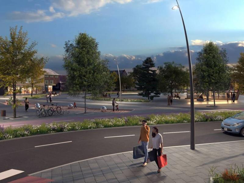
Formed from a shortlist of potential interventions, the concept designs bring to life projects that reduce car dependency by transforming streets into safer, more attractive spaces where daily needs can be met locally, and people travelling actively and by public transport are prioritised.
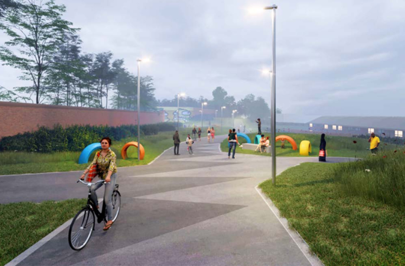
Highlights include visualisations of greenspace enhancements to the Dummy Railway Path in the north of the city and proposals for improved public realm and connectivity at Carntyne and Riddrie in the east.
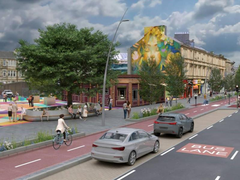
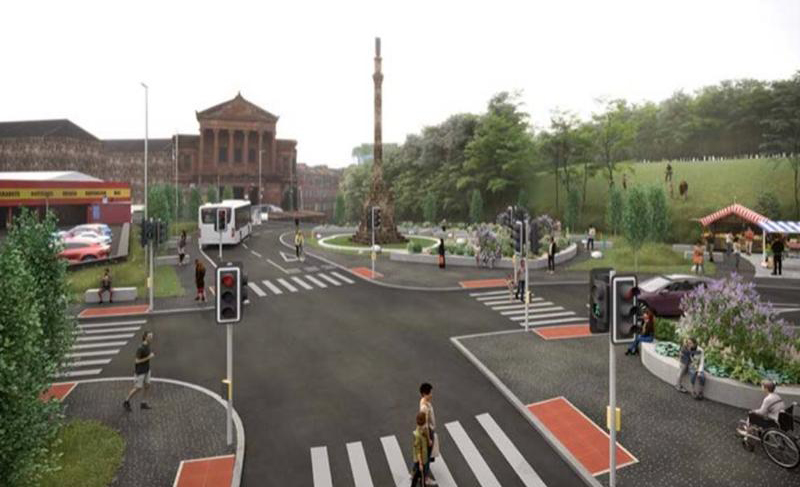
South of the river, designs illustrate rebalanced streets around the Battle of Langside Monument, whilst images for Cessnock Village Strip highlight segregated cycle ways and greenspace improvements. Illustrations for Lorne Street and Festival Park entrance also show a reinvigorated and improved civic realm.
Reports for each Liveable Neighbourhood:
 LN Dennistoun to Cranhill T1 RIBA Stage 2 [43Mb]
Battle of Langside Monument T1 RIBA Stage 2 [13Mb]
Toryglen Streets for People LN T1 RIBA Stage 2 [20Mb]
Dummy Railway LN T1 RIBA Stage 2 [18Mb]
Ruchill Street LN T1 RIBA Stage 2 [22Mb]
LN Govan to Kingston LN RIBA Stage 2 Part 1 [28Mb]
LN Govan to Kingston LN RIBA Stage 2 Part 2 [26Mb]
Councillor Angus Millar, City Convener for Climate and Transport, said: “I’m delighted to see the Concept Design Reports published for this first set of Liveable Neighbourhoods which really bring to life the transformative nature of this programme.
“Shortlisted projects for potential further development include safer and more attractive public realm in Riddrie, streetscape improvements around the Battle of Langside Monument and the introduction of tree planting, raingardens and active travel routes in Cessnock.
“As part of our citywide Liveable Neighbourhoods plans, we are looking at Glasgow, street by street, community by community, and finding ways to connect and improve our local neighbourhoods.
“Interventions such as reducing traffic flow or making it easier to walk or cycle to the shops have the potential to collectively deliver rebalanced, safer streets that make a real difference to people’s quality of life.
“These concept designs have arisen from immersive community engagement and by listening to the needs and aspirations of local people.
“By enabling residents to have their day-to-day needs met within a short distance of their home, and by creating streets that are more suitable for walking, wheeling and cycling, active travel will become a more natural choice for local journeys, reducing car dependency and encouraging greater footfall to local shops and businesses.”
Connecting Communities grant funding from Sustrans Scotland Places for Everyone programme has funded early development work. Further progress, and ultimately project construction, would be subject to future funding availability.
Also included in the first tranche is the Yorkhill to Anderston area, which incorporates Kelvinhaugh and Finnieston. Concept design work for this neighbourhood is underway and will be completed in the autumn.
Liveable Neighbourhoods is Glasgow’s approach to blending the 20-minute neighbourhood concept with the place principle to respond to the current environmental, social, health and economic challenges the city faces. Through six tranches of work, the programme will reach into all areas of the city.